Bike Orlando
Over 40 Bike Trails, 300+ Miles
Ride Safe, Greater Orlando, Disney Area
Trail Maps & Photos Galore
You are here >
Home >
Orange County >
Maitland Bike Route
Latest update: December 2024
Maitland, Florida Biking...
North Orange County Neighborhood Biking
The City of Maitland has a growing network of bike paths, with Bike Route (BR) signs posted along paths, trails, and bike lanes throughout the city, plus "Wayfaring" signs point to parks, schools, and points of interest. On Maitland's east side, recreational bikers can easily ride 5+ miles (round-trip) while taking in some shady parks and other interesting features. Maitland's west side, now connected via an east-west route with a bridge over I-4, has a growing series of trails leading to parks, sports faciities, and businesses. (Map and photos below.)
Location: Maitland, FL (Orange County)
Mileage: East Maitland, 5-6+ miles, depending on in-town Bike Routes;
East-West Connector, 1.75 miles; West Maitland,
3+ miles depending on route
Surface: Paved, 5'-10' - dedicated trail and bike lanes
Trailheads/Parking: Lake Lily Park, Maitland Community
Park, Minnehaha Park. (See map)
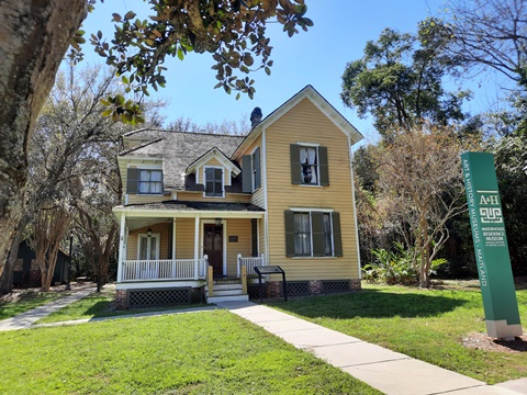
Nearby Points of Interest: Maitland Art Center, William
Waterhouse House Museum, Audubon Center for Birds of Prey, Enzian Theater
Bike Shops / Rentals:
Trek Bicycle
Florida
(Casselberry; sales, service) (formerly David's World Cycle)
Advanced
Cycles (Maitland; sales, service)
Page Summary:
- Maitland FL Biking
- East Maitland Bike Route - 5+ miles
- Lake Lily Park, Independence Square, Maitland Community Park, Minnehaha Park, Covered Bridge Park - East-West Connector - 1.75 miles
- Sandspur Rd., I-4 Bridge - West Maitland Bike Routes - 3+ miles
- Lake Destiny Soccer Fields, Maitland Ballfield Complex, Fennell Park - More Information and Resources
Maitland FL Biking... Comments and Photos
Here we map three bike routes:
- A 5-mile route in east Maitland that connects several parks, commercial and residential areas, on a well-marked combination of mostly bike paths with some bike lanes.
- The multi-use trail which runs parallel to Sandspur Road and links to a bike bridge over I-4, connecting the east and west sides of town.
- 3+ miles in west Maitland on a combination of multi-use trails and bike lanes, linking to parks, sports facilities, and businesses.
East Maitland Bike Route - 5 miles
For a short (5 mile) ride, our east Maitland bike route packs in a
lot, including 5 parks. Mostly following the
well-marked Bike Routes, we visit Lake Lily Park,
Independence Square, Maitland Community
Center, Minnehaha Park, and Covered
Bridge Park. Watch for intersecting Bike Route and
Wayfaring signs leading to parks, schools, history and art centers
and more - additional miles can be added depending on
your destination.
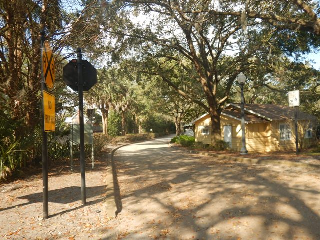
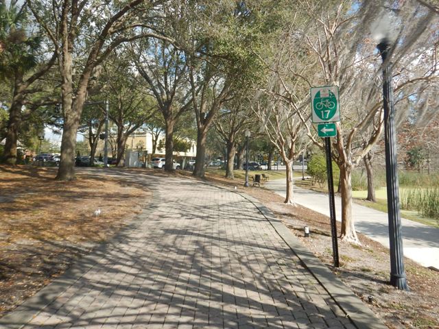
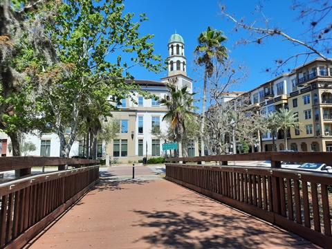
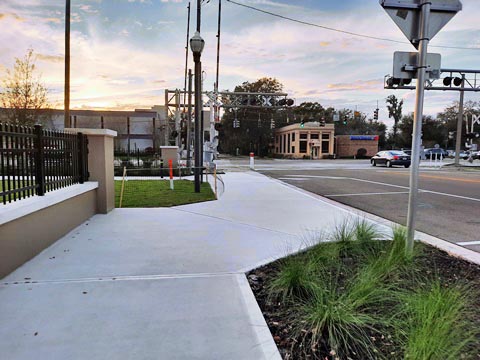
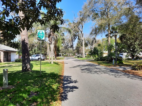
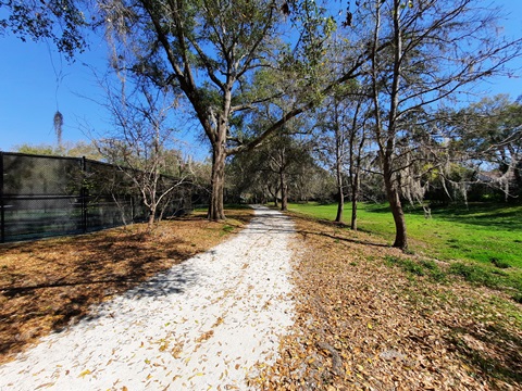
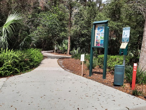
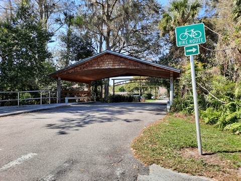
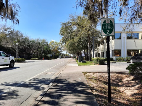
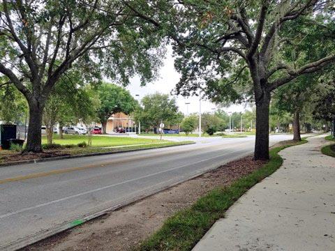
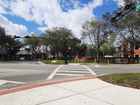
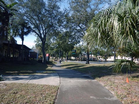
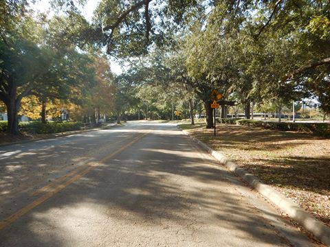
Lake Ave. to Lake Lily Park (BR 17)
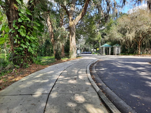
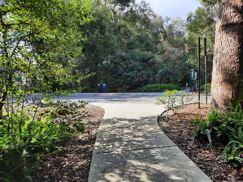
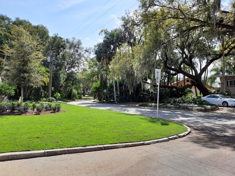
The bike route starts as the Bob Sonnenberg Blue Bicycle Trail (BR 17) at Lake Avenue. A boardwalk runs along the railroad track, then the path continues about 2/10 mile to a rail crossing and entry to Lake Lily Park. The bike route runs on Lake Lily Drive (a lightly used connector shared with cars) a very short way, then at the parking lot branches off onto a parallel walking path that circles the lake. The route here is shared with pedestrians, then it splits - go left to continue on the bike route.
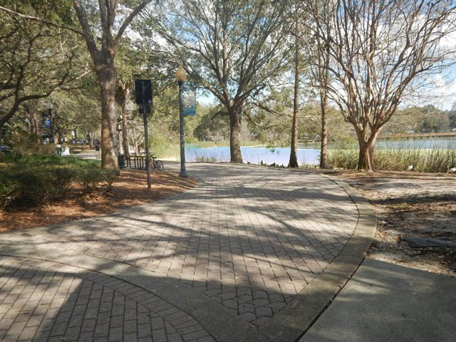
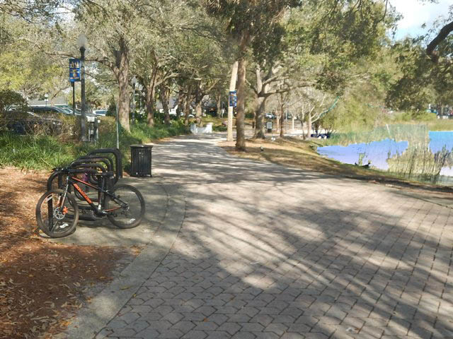
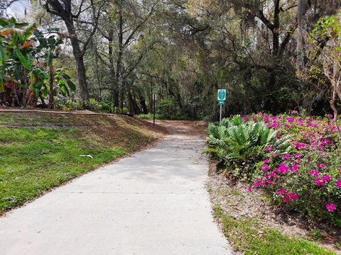
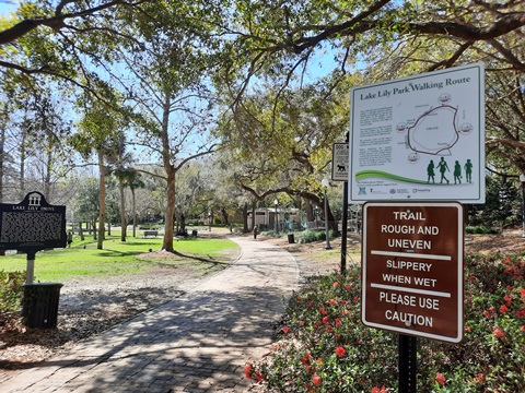
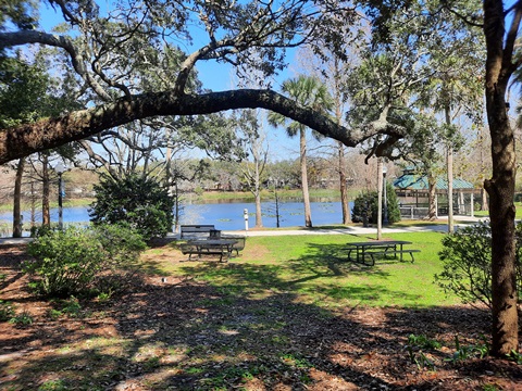
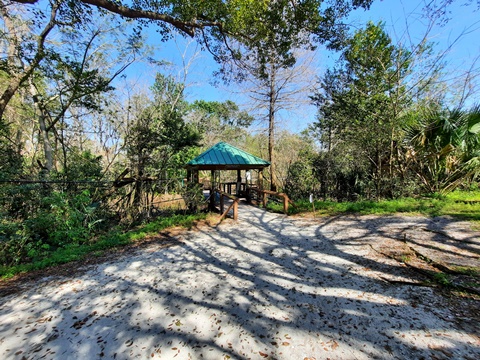
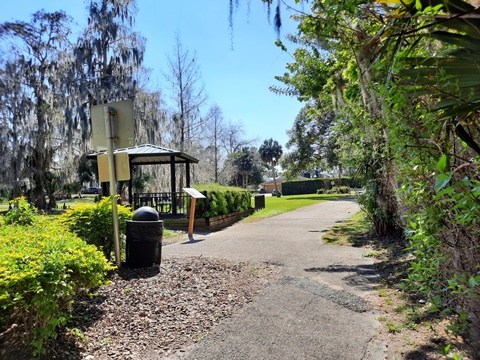
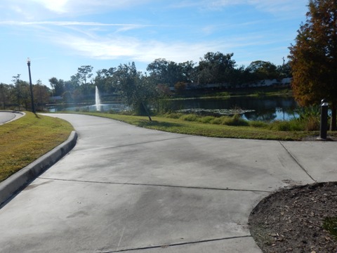
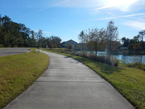
Lake Lily Park
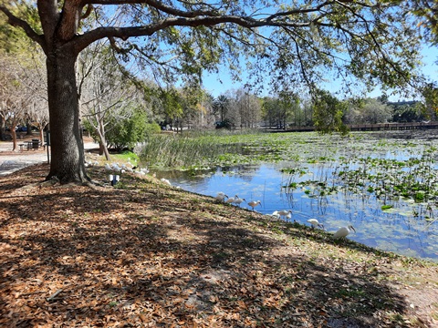
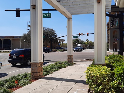
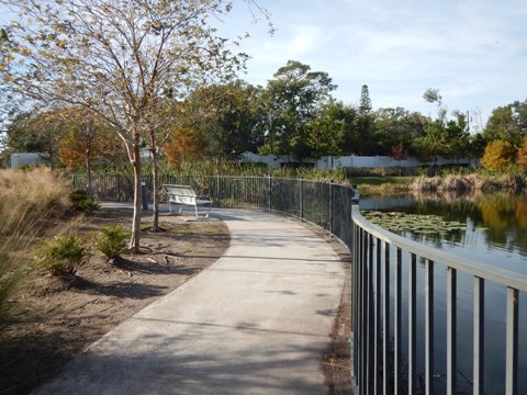
You may find some shady parking here. Lake Lily Park off US17-92 is centrally located and a local treasure. The park has parking, restrooms, water, playground, picnic tables, walking trail, gazebo, and a boardwalk. Historic markers tell of the history of the area, and the park also includes the historic Waterhouse Residence.
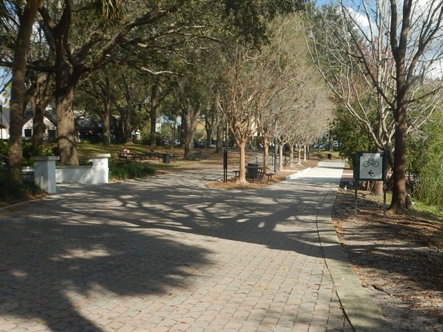
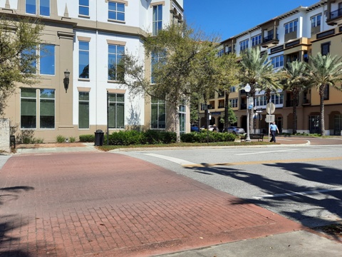
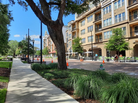
Lake Lily Park to Independence Square
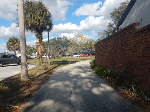
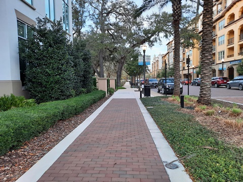
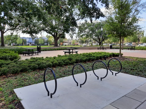
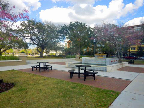
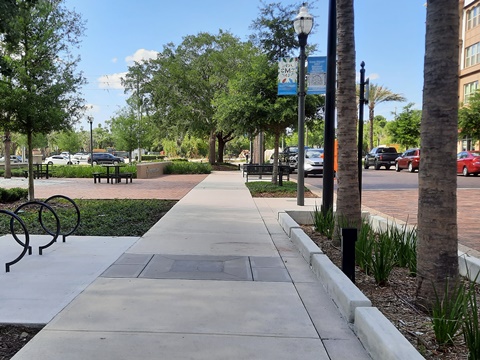
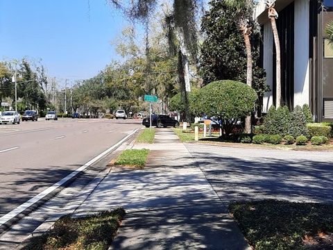
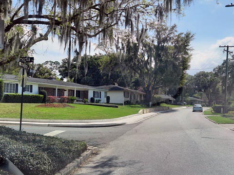
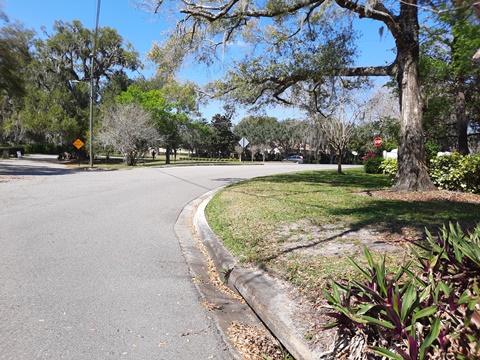
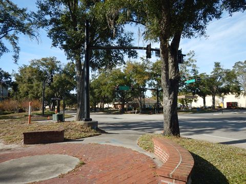
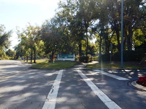
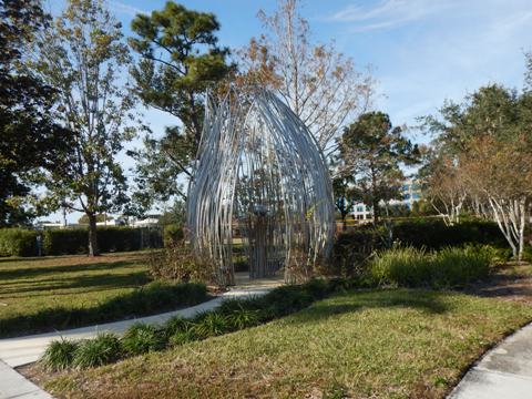
Continuing from Lake Lily Park, the path crosses Maitland Avenue then winds behind some businesses - there's one road crossing and some business entrances in this area,, so be careful. It then runs over another boardwalk, and ends at Packwood Avenue by the City Hall. Cross Packwood Avenue, turn right and then left onto the path along Independence Lane. Here, Independence Square has restrooms, benches, picnic tables, fountain and event lawn. Along Independence Lane are restaurants and apartments. At the end of Independence Lane, construction can be seen across E. Horatio Avenue, this will eventually extend the path to George Avenue. For now, to continue on the bike route, turn left at Horatio and then right on sidewalk next to Maitland Avenue.
Lake Lily Park to Packwood Ave.
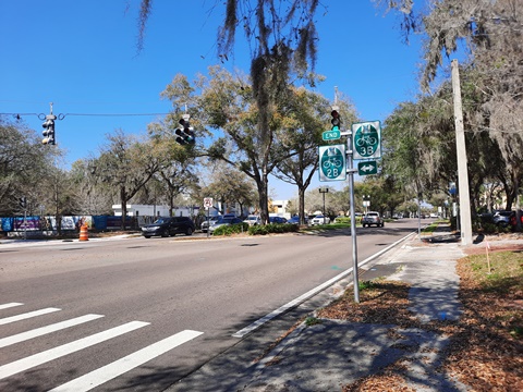
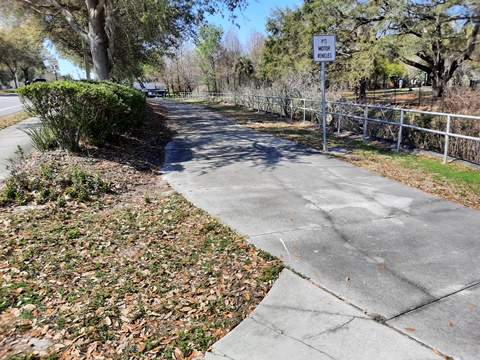
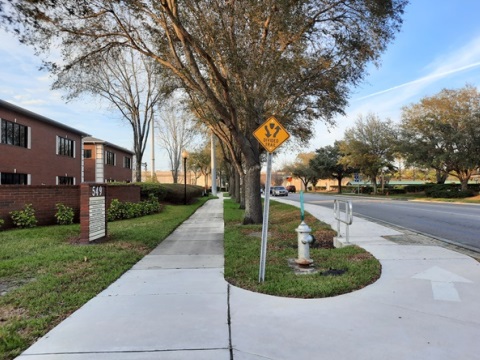
Maitland Ave. from E. Horatio to Maitland Community Park (BR 2B, 3B, 3)
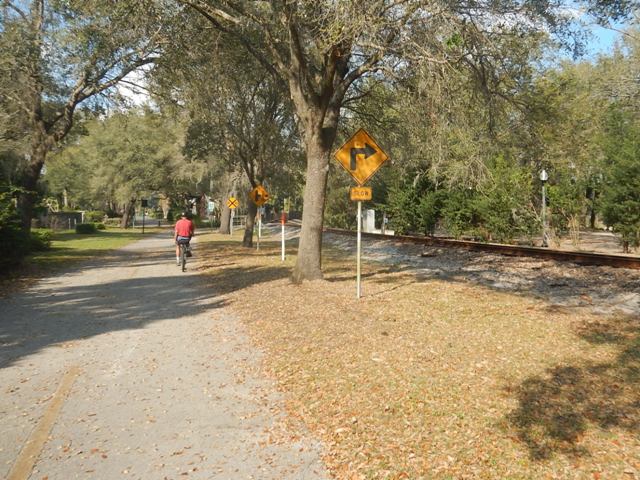
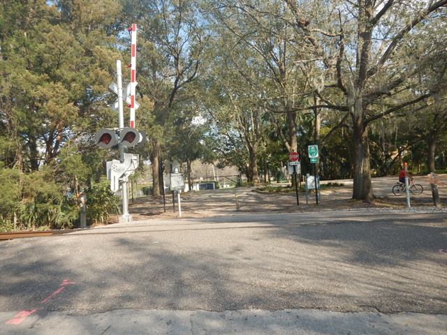
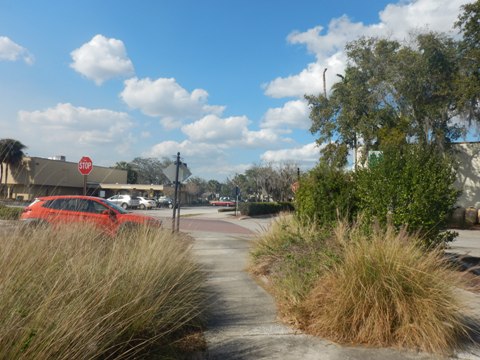
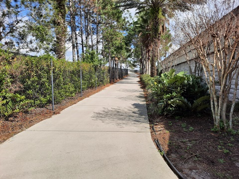
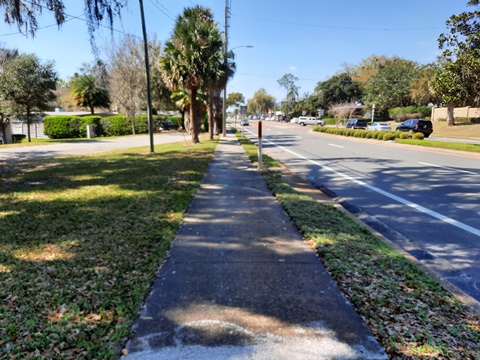
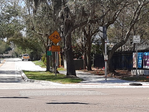
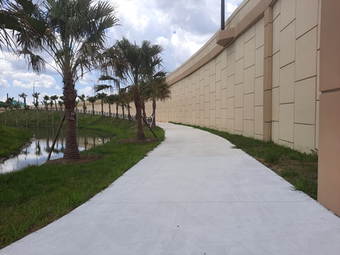
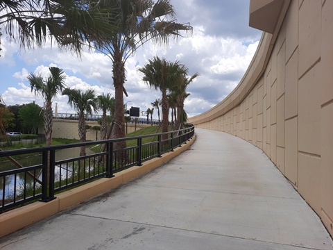
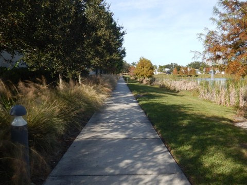
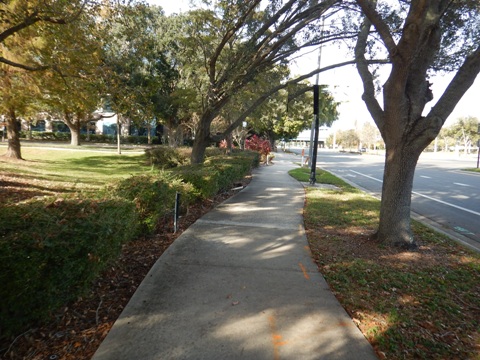
Maitland Avenue (BR 2B) is a busy road with no bike lanes, be aware - or use the sidewalk. (Note: when riding on sidewalks, always yield to pedestrians and give audible signals when passing.) After about a half mile, BR 2B ends. Turn right at Bridle Path (BR 3B, across from Sandspur Rd.) then left on Gamewell Avenue (BR 3) and ride about 1/4 mile to Greenwood Road where the path picks up again. Ride through the tunnel under Greenwood Drive and you're at the 17-92 overpass. Across the overpass, the path continues along Mayo Avenue (BR 3) with welcome shade provided by large oak trees lining the way. A roadside boardwalk is another bonus as you approach Maitland Community Park.
Maitland Ave. to Gamewell Ave. (BR 2B, 3B, 3)
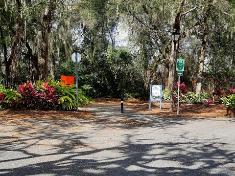
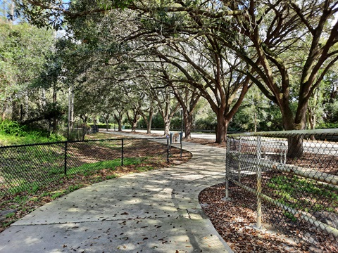
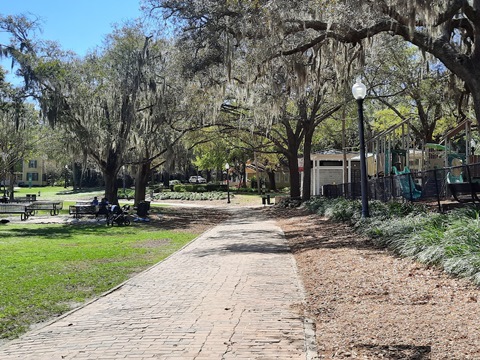
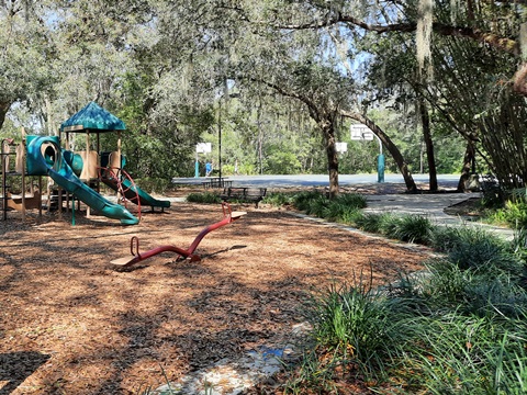
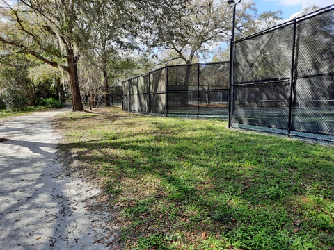
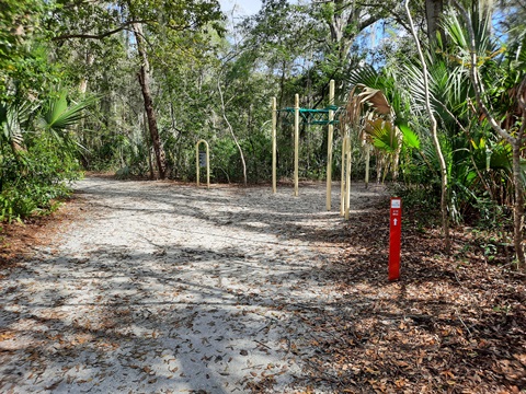
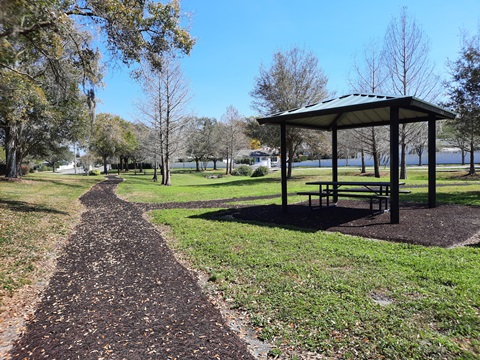
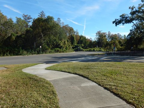
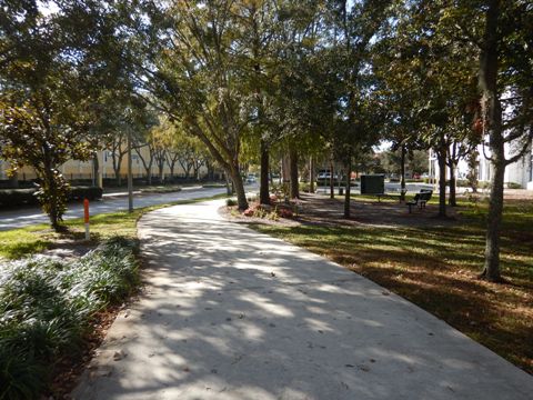
Maitland Community Park
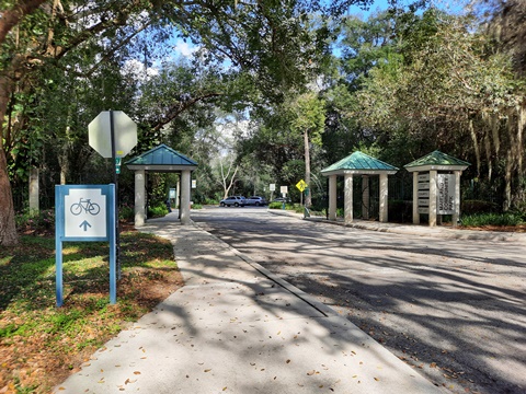
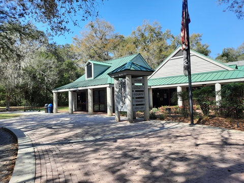
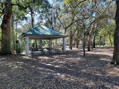
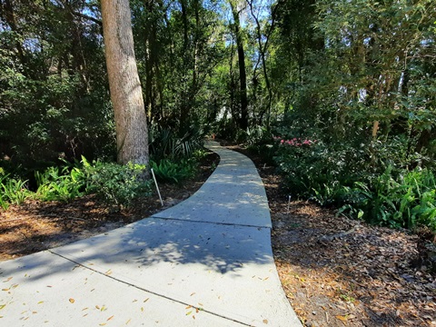
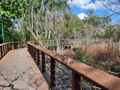
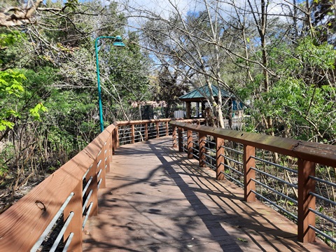
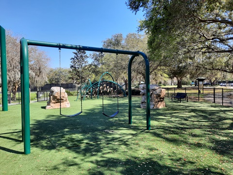
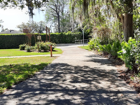
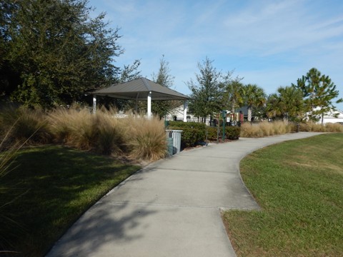
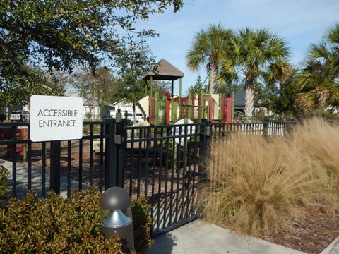
Maitland Community Park is a gem, a lovely 25-acre oasis with parking, restrooms, community building, 2 playgrounds, picnic pavilions, walking/jogging trails, tennis, basketball and racquetball, plus a 600-foot boardwalk. We stopped to explore the park before continuing our bike ride, and also walked a loop trail within the park along a fitness course. The trails are not long, about a mile in total - they intersect or overlap, and may include "Yellow," "Red" and/or "Blue" markers. Note: Mayo Avenue is the only entry to Maitland Community Park by car. The entry/exit at Arapaho Trail provides pedestrian and biking access.
Trail to Boardwalk and Exit
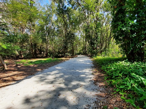
Our bike route follows the trail marked "Blue" and "Yellow" which starts on the right just inside the park entrance, past the community center and tennis courts, to the boardwalk (where bikes must be walked), and exit at Arapaho Trail (about 3/10 mile). This trail starts as paved then becomes sand and gravel, but still bikeable.
"Red" Trail/Fitness Course and Park Facilities
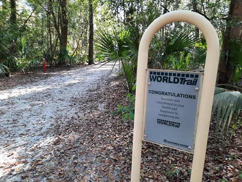
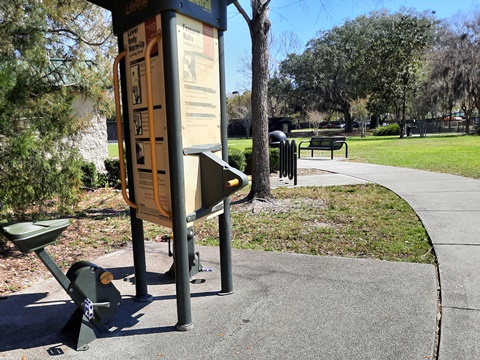
Our walking loop (about 4/10 mile) within the park started and ended at the parking area just inside the park entrance. The WorldTrail Fitness Course ("Red" Trail, also bikeable) starts to the left at the entrance, it includes a series of fitness stations, passes the boardwalk, and ends near the tennis courts. From there, we continued on the trail to return to parking. Except for a paved portion approaching the parking area, this is a sand and gravel trail.
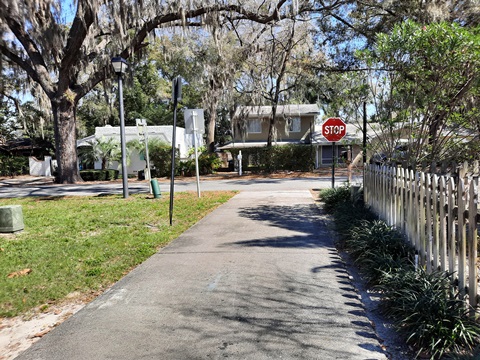
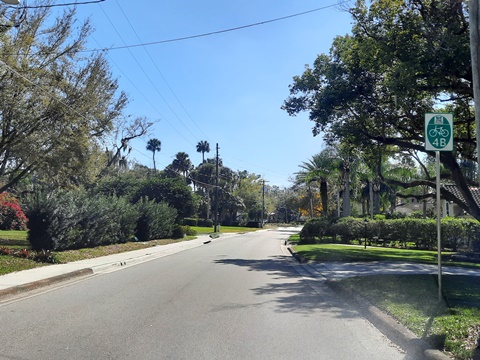
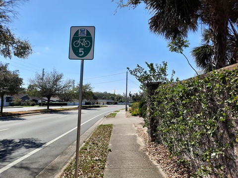
Maitland Community Park to Minnehaha Park (BR 4B, 5)
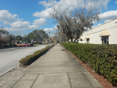
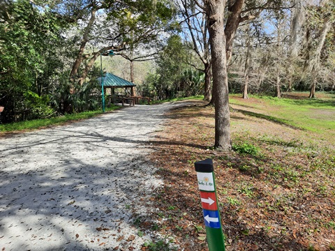
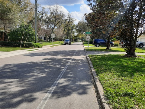
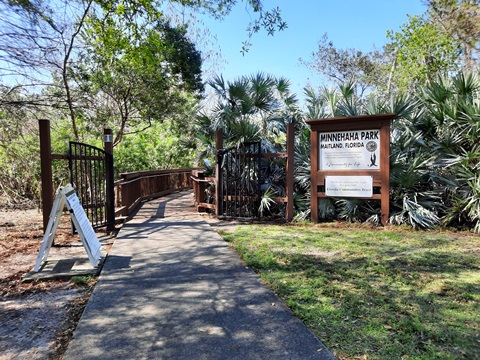
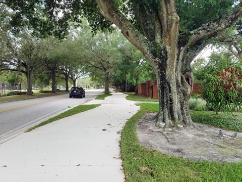
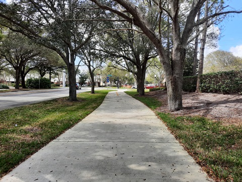
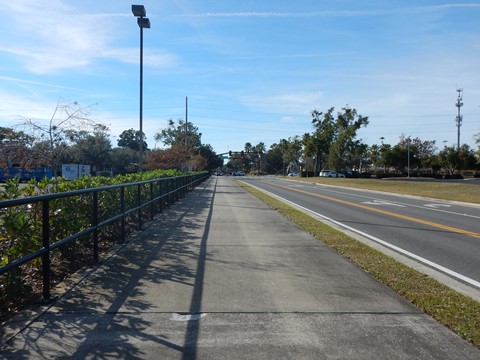
Exiting Maitland Community Park, follow the markers for BR 4B, starting on the bike lane along Arapaho Trail to Chippewa Trail - turn right. Continue to Sequoia Trail and turn left, then at Dommerich Drive turn left again and continue to E. Horatio Ave. There's an improved sidewalk along Dommerich from Choctaw Trail to Horatio, otherwise this is on-road with bike lane and sharrow. From Dommerich Drive along Horatio Ave.(BR 5) is about 3/10 mile to Minnehaha Park - there's a bike lane, but due to heavy traffic riding on the sidewalk is advisable (remember to yield to pedestrians). Turn right at Minnehaha Park. To continue on our bike route, watch for the multi-use path near the entrance - or stop for a break and to enjoy the views.
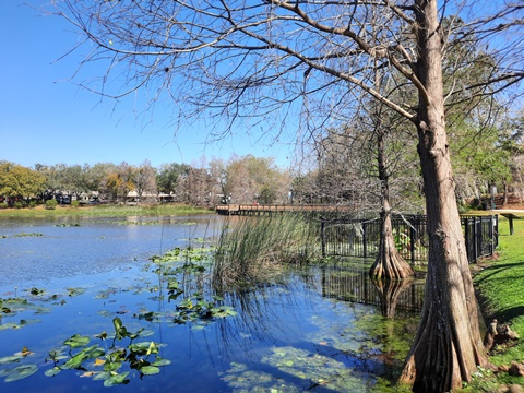
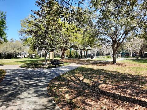
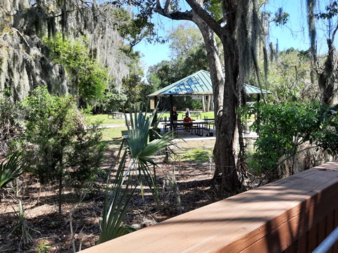
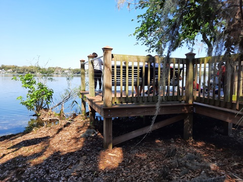
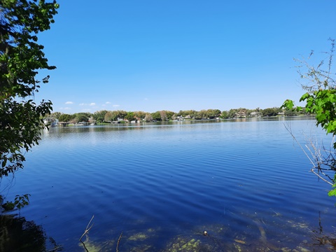
Minnehaha Park is another gem. It offers parking, restrooms, picnic area, playground, boardwalk, and a fitness course. The boardwalk was a pleasant surprise, leading to an observation deck with views of Lake Minnehaha. More about Minnehaha Park .
Maitland Community Park to Minnehaha Park

Closing the Loop (BR 5, 2)
Minnehaha Park to Covered
Bridge Park and Packwood Ave.
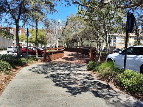
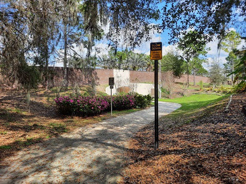
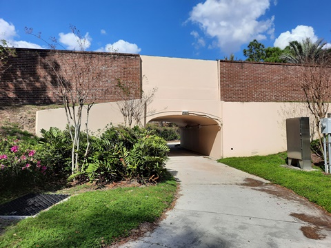
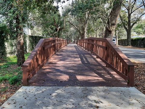
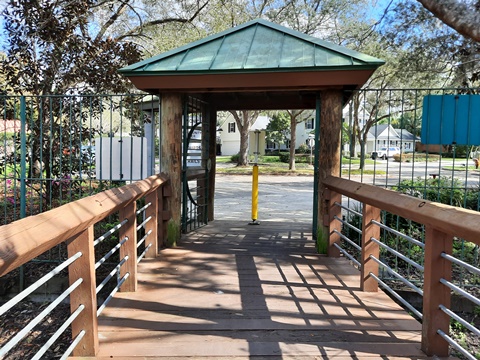
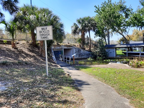
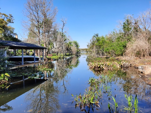
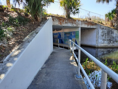
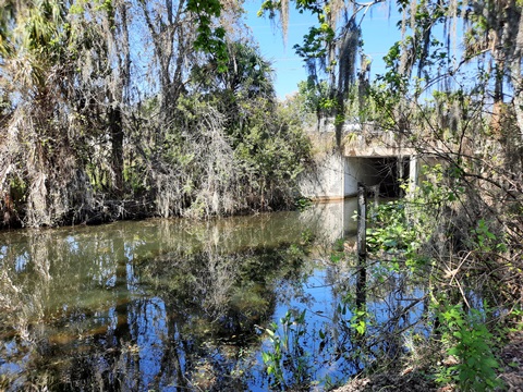
At the main entrance to Minnehaha Park off E. Horatio a separate multi-use path starts, paralleling the roadway as it goes to a tunnel under E. Horatio that runs along the Nina Canal. Nina Canal connects Lake Minnehaha to Lake Nina and Lake Maitland (part of the Winter Park Chain of Lakes, link below). The tunnel exits to Covered Bridge Park. This is a small but pleasant park with picnic pavilions and a walking trail, plus of course the landmark wooden covered bridge over Nina Canal.
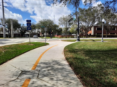
Past Covered Bridge Park, the path comes to Old Horatio Road. Turn right and cross the covered wooden bridge over Nina Canal, past Jim Houser Azalea Garden. and back to E. Horatio Ave. There's a bike lane on E. Horatio, but given the traffic and short distance (1/10 mile to Swoope Ave.) riding on the sidewalk is advisable. Turn left on Swoope Avenue (BR 2), and then right on Packwood Avenue (BR 2 continues). Cross US17-92 and continue to the boardwalk (BR 17), and return to Lake Lily Park.
Minnehaha Park to Covered Bridge Park
East-West Connector
The East-West Connector is a bike route from Maitland Community Park (east) to Fennell Park (west), including dedicated paths, bike lanes, and on-road. To the east, it runs from Maitland Community Park to Maitland Ave. via Bridle Path (route outlined above). Then the trail along Sandspur Rd. leads to Wymore Rd. and the I-4 bridge, connecting to the west side and running to Fennell Park via N. Lake Destiny Rd. and Southhall Lane (outlined below).
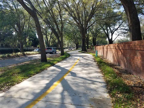
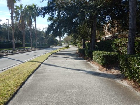
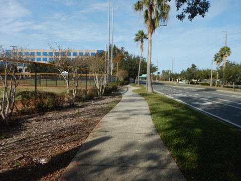
Sandspur Road Trail (BR 3B) - 1.25 miles
The 1.25 mile Sandspur Road Trail (BR 3B) runs from North Maitland Avenue to North Wymore Road. The 10-foot wide, multi-use pathway runs on the north side of Sandspur, and passes both Lake Sybelia Elementary and Orangewood Christian Schools. At the Maitland Avenue end, the path is across the street from Bridle Path and connection to Maitland Community Park (see above). At the Wymore Road end, it continues to the I-4 bridge.
Wymore Rd. to Lake Destiny Drive - 0.5 mile
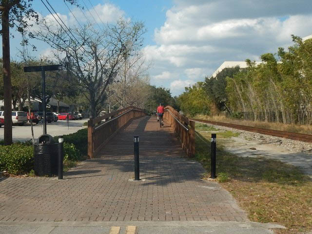
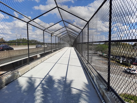
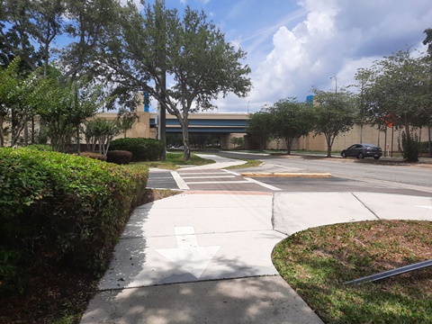
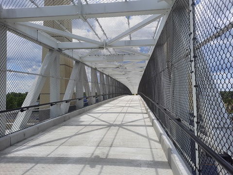
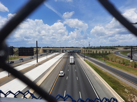
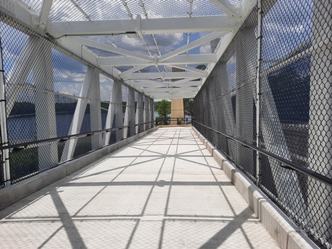
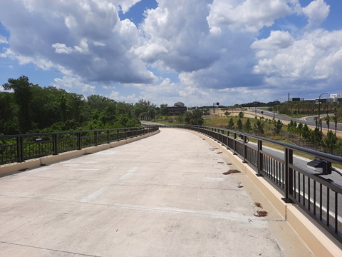
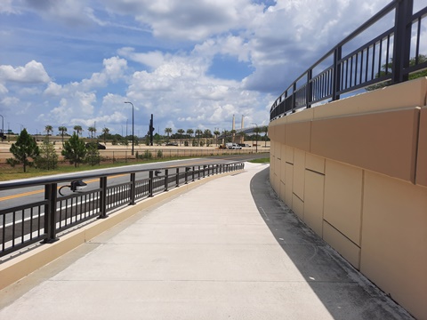
Wymore Road to I-4 Bridge
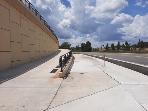
From the end of Sandspur Road, cross Wymore Road and go right, the path runs roadside toward Maitland Blvd. Just before the underpass, it then turns left onto the ramp to the I-4 bridge.
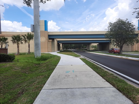
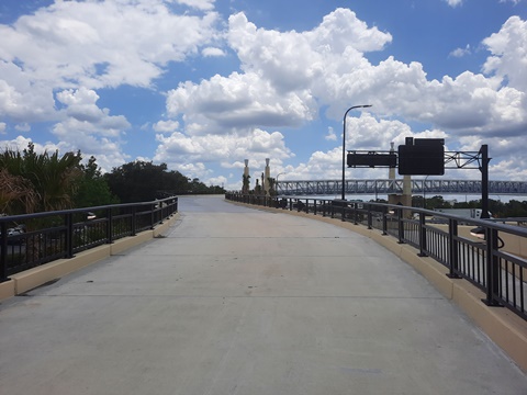
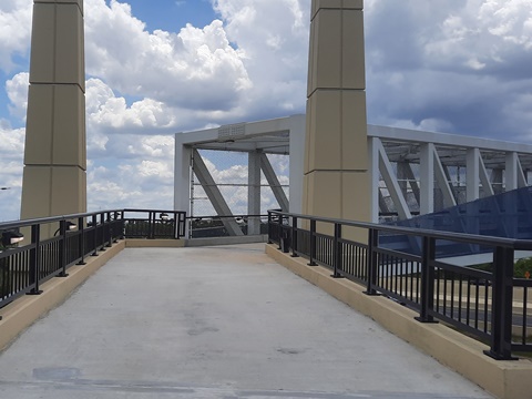
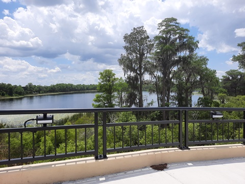
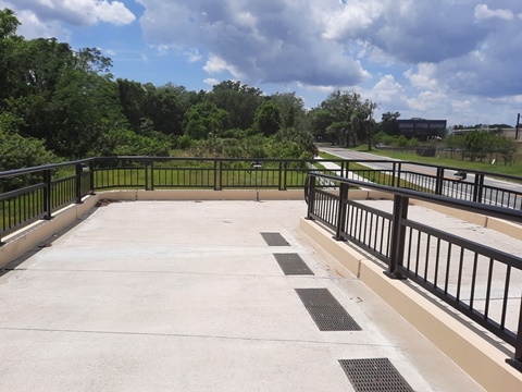
I-4 Bridge to Lake Destiny Drive
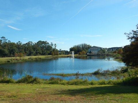
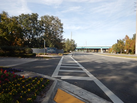
The bridge has lights, so useable after dark. At the western end of the bridge is a nice view of Lake Lucien. After crossing the bridge and down the ramp, the bike trail meets Lake Destiny Drive.
West Maitland Bike Routes - 3+ miles
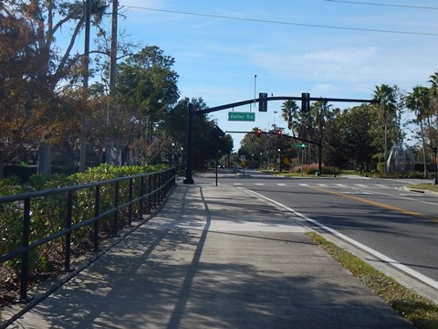
Trails are evolving on the west side of Maitland, consisting of a combination of off-road trail, roadside paths/sidewalks, and bike lanes. From the I-4 bridge, our route runs along N. Lake Destiny Rd. to Southhall Lane to S. Keller Rd., the Maitland Ballfield Complex and Fennel Park. This route includes business parks, municipal facilities, restaurants and hotels.
- The network is growing, with the West Side Trail Project being implemented to create a recreational loop to circle Lake Lucien, connecting parks, sports facilities, and businesses.
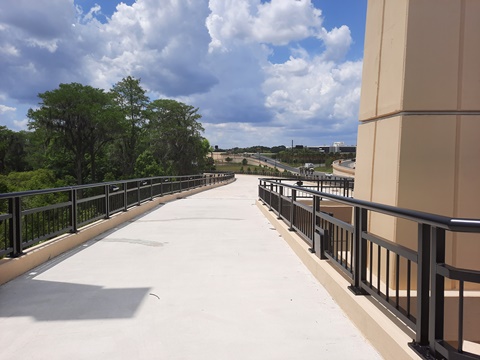
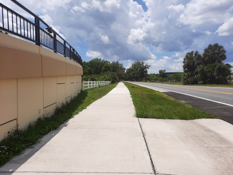
Trail along N. Lake Destiny Drive
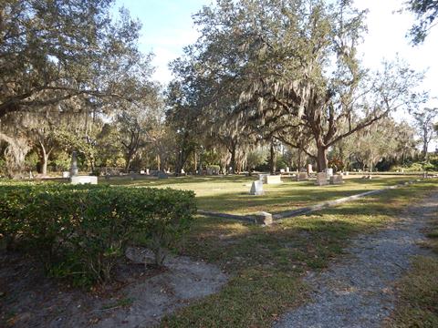
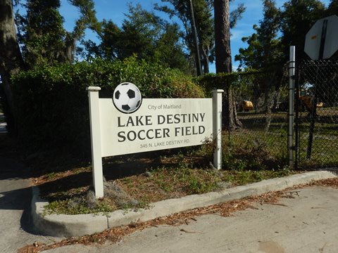
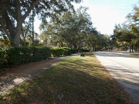
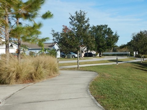
From the I-4 bridge, the bike trail continues west along N. Lake Destiny Drive, passing Maitland Cemetery (dating from 1892), to the Lake Destiny Soccer Field. The trail ends here, and merges to a more narrow sidewalk (eventual plans to extend the trail as part of the West Side Trail Project. Continue on the sidewalk - yielding to pedestrians - or use the bike lane (Bike Route 1) along N. Lake Destiny Drive.
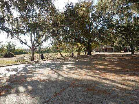
Lake Destiny Drive to Maitland Ballfield Complex
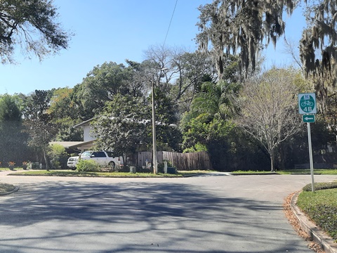
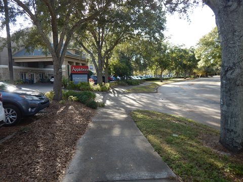
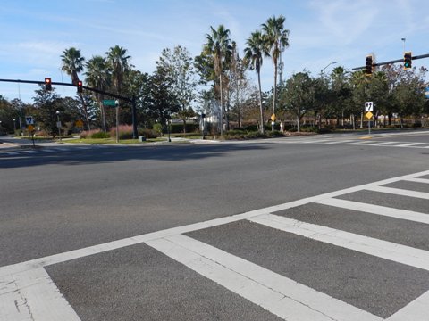
At Southhall Lane (Applebee's Grill) are two options for proceeding to the Maitland Ballfield Complex (home of Maitland Little League): (1) go straight onto Lake Lucien Drive and continue in the bike lanes (or sidewalk) to N. Keller Rd., then follow N. Keller to Fennell St. at the ballfield complex, or (2) turn left onto Southall Lane, passing Applebee's and a hotel, ending at Keller Rd. and the ballfield complex.
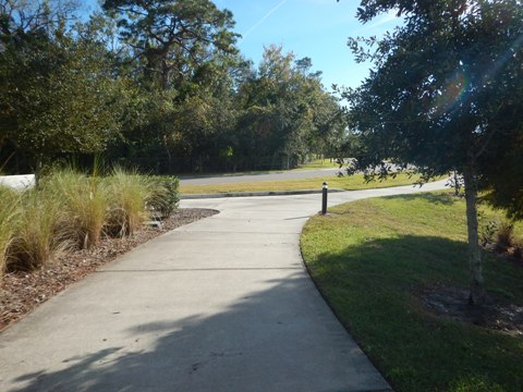
- We used the second option - it's a quieter road. There's an off-road path/sidewalk that's bikeable but winding and narrow in parts - we biked it part-way but found it easier to ride in the lightly traveled road.
- When the road curves to the right, the off-road
Southhall Lane Trail begins, running 1/10 mile to Keller
Rd. - cross to the ballfield complex.
Note: Eventually, plans are to modify Southhall Rd. to accommodate the trail, as part of the West Side Trail Project.
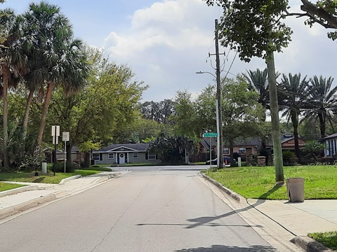
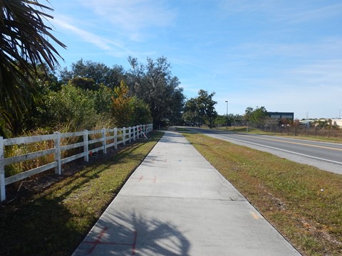
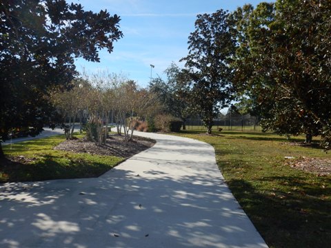
Fennell St. Trail
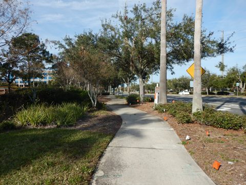
- Southhall Lane ends at Keller Rd., becoming Fennell St. across the road at the playing fields. The paved Fennell St. Trail runs 8/10 mile off-road alongside Fennell St., passing the Maitland Public Works complex (police, fire) and entering a residential area leading to Fennell Park (picnicking, playground).
- The trail loops around a lake here (about 3/10 mile), providing links to surrounding neighborhoods.
Keller Rd. to Fennell Park
Keller Rd. Trail - 0.6 mile
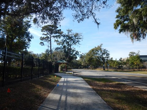
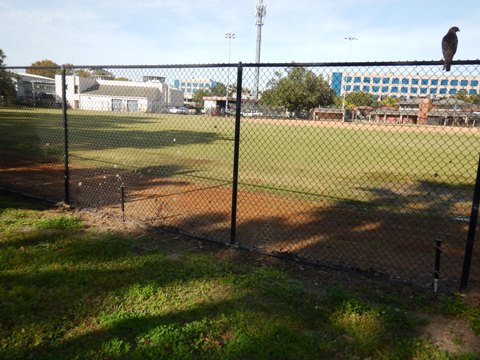
- From the juncture with Southhall Lane/Fennell St., an off-road trail runs north along the west side of Keller Rd. It passes the Ballfield Complex, and runs under Maitland Blvd. to the Genesis Health Orlando Sportsplex (formerly, the RDV Sportsplex). We went a short distance toward Maitland Blvd.
- Another section of off-road trail is at Lucien Way to the south, but we haven't visited there yet.
More Information and Resources
About Maitland:
We like the town's original Seminole Indian name Fumecheliga, or "Musk Melon Place." Here's interesting information on Maitland's history.
Nearby Biking:
City of Winter
Park
Casselberry
Greenway
Kewannee
Trail (Casselberry)
Nearby Paddling:
Related Resources:


Copyright ©BikeOrlando.net. All Rights Reserved.