Bike Orlando
Over 40 Bike Trails, 300+ Miles
Ride Safe, Greater Orlando, Disney Area
Trail Maps & Photos Galore
You are here > Home >
Orlando Downtown Loop
Latest update: February 2023
Orlando Downtown Loop
Linking Orlando Downtown Area Bike Trails
Orlando has an aggressive pedestrian and biking plan to eliminate fatalities by the year 2040. Part of that effort is to develop a continuous Orlando Downtown Loop (formerly called the Orlando Bicycle Beltway), which is already emerging. This effort uses portions of existing bike trails and is filling gaps to eventually create an 8.5 mile trail loop connecting locals to neighborhoods, shopping, dining, parks and offices. See map. (Note: On our Google map, in addition to the Loop and gaps, we believe it useful to include the entirety of the connecting bike trails, so at a glance you can view all nearby cycling options.)
Below we list the Orlando Downtown Loop trails, connectors, and remaining gaps, starting on the Orlando Urban Trail at Magnolia Avenue and looping through Downtown Orlando going counter-clockwise.
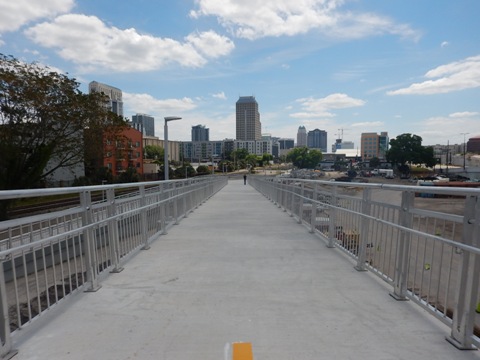
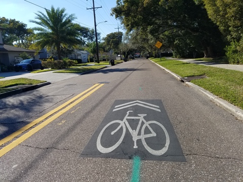
Orlando Urban Trail / Downtown Orlando (Magnolia Ave. to W. Washington St., 1.5 miles) - Starting in Orlando's North Quarter district on Magnolia Ave. near Weber St., this segment of the Downtown Loop runs through Downtown Orlando. From Magnolia Ave. take Weber St. to N. Orange Ave., cross the bridge over W. Colonial Dr., proceed past the Lynx Bus / SunRail Train Station at W. Livingston St., and continue to Gertrude's Walk at W. Jefferson St. A gap in the Loop then begins from Gertrude's Walk at W. Washington St.
Downtown Gap - Gertrude's Walk to S. Summerlin Ave. at E. Anderson St. (about 1 mile, under design). This segment will consist of cycle tracks and wide sidewalks along Washington St., Magnolia Ave., Pine St., Eola Drive and Summerlin Ave.
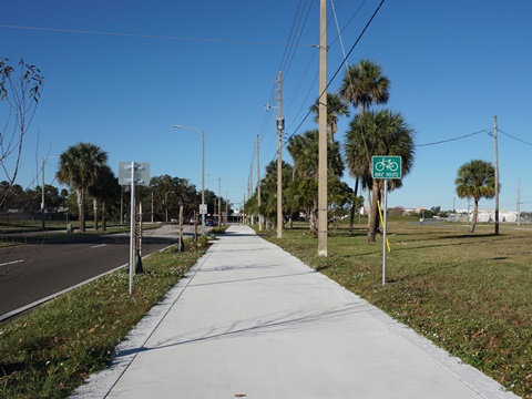
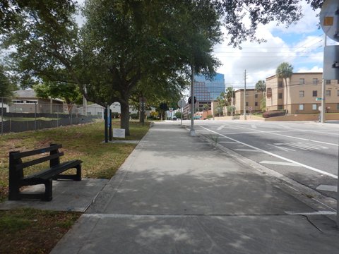
Orlando Downtown Connector - Running along E. Anderson St. about 1.7 miles from Summerlin Ave. to the Lake Underhill Path. Multiple road crossings, the busiest at Summerlin Ave., Mills Ave., Bumby Ave., Primrose Dr., Crystal Lake Rd. and Lake Underhill Rd. (crossing signals provided).
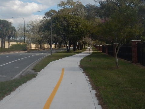
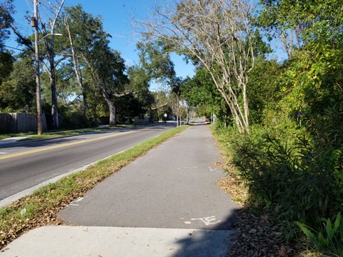
Lake Underhill Path - 3 mile trail running past Orlando Executive Airport that links four Orlando City Parks: Orlando Festival Park, Col. Joe Kittinger Park, Lake Underhill Park, and Park of the Americas.
Downtown Loop segment: From Anderson St. cross Lake Underhill Rd. and go under the SR 408 expressway to South St., then proceed north on Crystal Lake Rd./Maguire Blvd. to E. Colonial Drive (SR 50) (1.2 mile). Cross busy Colonial Drive very carefully, then follow Maguire Blvd. to Woodcock Rd. where it meets the Cady Way Trail (1/4 mile).
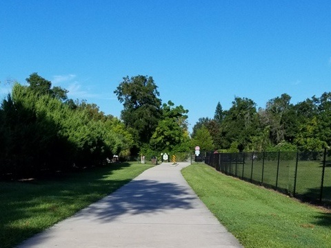
Cady Way Trail
7.5 miles total through sections of Orlando and Winter Park.
Connects to the Cross Seminole Trail at the Seminole County Line,
and to Lake Baldwin Trail at Baldwin Park.
Downtown Loop segment: Cross Maguire Blvd. at Woodcock Rd. and turn left one block to Warehouse Rd. Continue to Lake Druid Park (1/2 mile).
On-street route
- Cady Way Trail to Orlando Urban Trail
Marked street route runs about 1.7 miles from Cady Way Trail at
Lake Druid Park to the Orlando Urban Trail at Lake
Highland Dr. and Ferris Ave.
Bumby Path - E. Colonial Drive to Corrine Drive, 1 mile; crosses the street route between Cady Way Trail and Orlando Urban Trail.
Orlando Urban Trail - Follow the Orlando Urban Trail along Lake Highland Avenue west to Magnolia Avenue (about 0.6 mile) to complete the Loop.
More Information and Resources
More Nearby Biking:
Orange County Trails - see Overview Map for more nearby
Resources:
City of Orlando -
Downtown Loop
City of Orlando Bicycle Plan
City of Orlando -
Bicycle and Scooter Registry
See all bike trails in Orange County

Copyright ©BikeOrlando.net. All Rights Reserved.